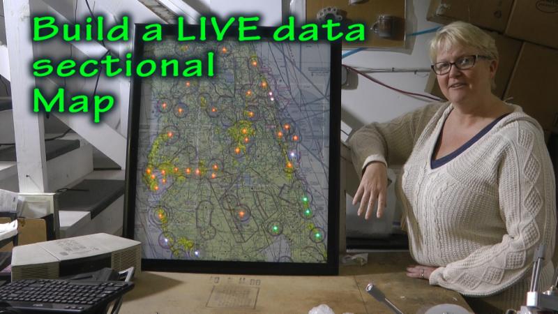
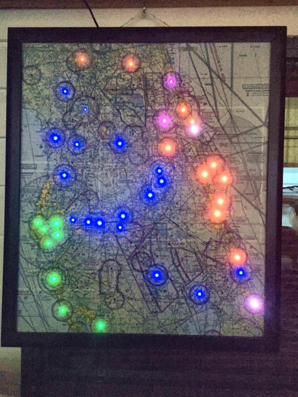
There are very creative minds at work as witnessed by a project 
                                    you may want to consider:
                                     taking your favorite paper sectional map and
                                     making it come alive with live weather information
                                    . 


                                    Specifically, colored LED lights 
                                    at airport locations of your choice 
                                    will indicate flight rule operations (VFR, MVFR, IFR, LIFR) in synch with METAR data from the National Weather service. A quick glance at this map will 
                                    inform pilots of weather conditions as they change in almost real time.


                                    Watch here for a demonstration and explanation of this fun project you can build yourself: